This month, we start with the latest HTZ updates, including developments across radar and wind farm analysis, interference reporting, fixed communications and mission planning. We also explore our expanding map data library, with new high-resolution datasets available at resolutions as low as 0.5 metres.
Elsewhere, we welcome new members to the ATDI team and head to South America, where our partnership with TES Horizons combines local expertise and support with flexible spectrum management technology.
Following EW Live 2026 in Tartu, Estonia, we focus on EMS digital twins and wargaming. ATDI demonstrated how HTZ Warfare, ICS Monitoring, and HiNT combine live drone detection, RF simulation, and AI-powered analysis to recreate changing EMS conditions, assess countermeasure performance, and support ongoing wargaming and situational awareness. Contact us to book a private live demonstration.
Finally, we cover important CRM changes, including two-factor authentication, and look ahead to upcoming events where you can meet the ATDI team.
 v.2026.9 and above: Latest HTZ features and enhancements
 The latest HTZ developments introduce new capabilities and workflow improvements across cartography, antenna management, mobile radiocommunications, network planning, spectrum management, HF, CCTV and fixed radiocommunications.
Key developments include new cartographic projections, improved antenna-pattern conversion, refined 4G interference calculations, enhanced building-data manipulation and a new software licence activation process.
CARTOGRAPHY AND MAP DATA
IC1/IC2 conversion using Look Up Tables: Map Data Converter now supports a text-format Look Up Table when converting between IC1 and IC2 files. Input and output values can be mapped using a table containing up to 1,000 entries, providing greater control over data conversion.
Building height scaling: Added a new “Building factor” option to the building modification tools. Users can apply a multiplication factor to existing building heights, allowing an entire selection of building data to be adjusted efficiently.
Brazil Polyconic projection: Added support for SIRGAS 2000 / Brazil Polyconic (EPSG:5880), using the grid code BRAPLC.
Canada Atlas Lambert projection: Added support for Canada Atlas Lambert – NAD83(CSRS) (ESRI:102002), using the grid code CATL.
Vector polygons to raster: A new “Add polygon contour” option lets you include polygon contour lines when populating a raster layer from vector polygons.
ANTENNA MANAGEMENT
PAFX to MSI antenna conversion: HTZ can now create individual MSI antenna files from each pattern contained within a PAFX file. MSI files can also be generated from the HTZ antenna catalogue and its associated PAP files. If an issue occurs during conversion, the HTZ Event Log records details.
This provides a more efficient way to convert and manage antenna-pattern data for use within HTZ.
MOBILE RADIOCOMMUNICATIONS
Refined 4G interference calculations: When the activity factor option is selected, the interfering power from 4G stations is now proportional to the sum of the percentage of power allocated to each system-overhead channel. This provides more representative interference calculations when transmitter power allocation across channels needs to be considered.
NETWORK PLANNING
Extended channel assignment: The Network Frequency Assignment function now includes an “Assign from cx #” option. This allows all channels from a selected channel number onwards to be assigned to each station, simplifying frequency-assignment workflows where multiple channels need to be allocated.
SPECTRUM MANAGEMENT
ICAO Building Restricted Areas: When a conflict is identified, the value 255 now appears on the map at the obstacle location, making conflicts easier to locate in the analysis.
HF PLANNING
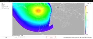
SNR map display within the current project: A new “On map” button has been added to the World Map & Overlays tab of the HF module. Users can now display the SNR map directly within the current HTZ project, providing a more integrated workflow for reviewing HF analysis results alongside other project information.
CCTV PLANNING
Greater CCTV field-of-view precision: The minimum supported CCTV field-of-view values have been reduced to 0.1° horizontally and 0.01° vertically, supporting analysis requiring very narrow fields of view.
Save and reload CCTV parameters: CCTV station parameters can now be saved to and reloaded from TRX files. Parameters include horizontal and vertical field of view, horizontal and vertical sensor resolution, and horizontal and vertical pan values. This makes CCTV configurations easier to retain, reproduce and reuse within HTZ projects.
LOCATION AND STATION REPORTING
Additional location reference systems: Station listings now include a “Location MGRS / BNGR / INGR / H3” column. The location format displayed is determined by the option selected within HTZ Preferences, extending the coordinate and location-reference information available within station listings.
COVERAGE AND EXTERNAL DATA
Improved handling of signed dB data: When the “dB (+-)” unit is selected, FD2 data can now be loaded into the 8-bit layer. This supports C/I and SNIR maps originating from external 16-bit files, including TIF and Grid ASCII data, providing a workflow for incorporating externally generated analysis results into HTZ.
FIXED RADIOCOMMUNICATIONS – MW AND PMP
Microwave antenna dimensions in generic link imports: Generic microwave link imports can now include the diameter or size of each microwave link head. This retains additional antenna information when importing microwave link data into HTZ and reduces the need to add these parameters manually after import.
HTZ LICENSING
New licence activation process: HTZ has introduced a new licence activation process to support both API-enabled and non-API-enabled licences. The revised process updates how HTZ licences are activated based on the licence configuration.
This month’s release includes an exceptionally high-resolution 0.5 m dataset for JFK Airport. At just 50 cm resolution, the dataset provides a highly detailed representation of the airport environment, including terrain, clutter and buildings.
This level of detail is particularly valuable in a complex airport environment, where terminals, hangars, and other infrastructure can significantly affect radio propagation.
The dataset supports detailed coverage and interference studies, private 4G/5G planning, critical communications, point-to-point links, IoT networks, and other applications where understanding the impact of the immediate physical environment matters.
Also released this month:
1 m Resolution – DTM / Clutter / Buildings: USA: SeaTac Airport (WA). Netherlands: Rotterdam. France: Vercors-Ventoux region
10 m Resolution – DTM / Clutter / Buildings: Canada: Inuvik (NT). USA: Alaska
20 m Resolution – DTM / Clutter: Kazakhstan. France: Kerguelen Islands
In addition to our latest releases, ATDI’s cartographic library contains a wealth of high-quality datasets from across the globe. From dense urban environments and major transport infrastructure to remote and rural regions, these datasets support accurate propagation modelling, interference analysis and reliable network design.
To explore the full range of available map data, click here.
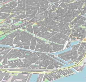
*The image shows a 3D view of our 1 m dataset for Rotterdam, Netherlands.
Book a Live Demonstration: Drone Detection, EMS Digital Twin and Wargaming
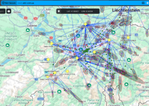
At EW Live 2026, ATDI demonstrated how HTZ Warfare, ICS Monitoring and HiNT combine live drone detection, RF simulation and AI-powered analysis.
ICS Monitoring detected and analysed live drone targets, then automatically transferred detections to HTZ Warfare. HiNT then assessed jamming network effectiveness, supporting continuous monitoring and “what-if” analysis as the RF environment changed.
The demonstration connected frontline sensors with the Defence HQ back end, supporting EMS situational awareness and wargaming.
Want to see it in action? Contact us to book a private live demonstration.
* Image: ICS Monitoring EWM module

ATDI continues to strengthen its presence across South America through its partnership with TES Horizon, combining local regulatory expertise with proven spectrum management and engineering technology.
TES Horizon’s Fusion & Monitoring Centre, working alongside ICS Manager and HTZ Communications through the API, transforms complex monitoring data into practical intelligence to identify spectrum occupancy, unused assignments and potentially unauthorised emissions.
With systems already in production and further projects underway, the partnership provides a scalable approach that evolves alongside each organisation’s operational requirements.
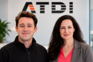
ATDI Group is strengthening its international team with two new appointments supporting the Group’s continued development across Europe and North America.
This month, we welcome Alexandre Massonnet as Head of Public Affairs and Dijana Winch as Strategic Account Executive at ATDI Inc. Both bring extensive experience in their respective markets and will help ATDI strengthen customer and institutional relationships.
Alexandre Massonnet – Head of Public Affairs
Alexandre joins ATDI Group with more than ten years of experience across public affairs, defence, security and international business development.
He will lead ATDI’s institutional engagement across Europe, developing relationships with European institutions, NATO, governments, Defence Ministries and key industry stakeholders. His role will also support ATDI’s strategic positioning across defence, security and technological sovereignty while developing new partnerships and opportunities.
Connect with Alexandre on LinkedIn.
Dijana Winch – Strategic Account Executive, ATDI Inc
Dijana brings more than 15 years of satellite communications experience, combining commercial expertise with knowledge of satellite capacity, spectrum planning and service delivery.
Working with customers across North America, Dijana will support organisations applying ATDI’s spectrum management, radio planning and analysis capabilities to their technical, operational and regulatory requirements. Her experience spans multi-orbit satellite capacity, spectrum coordination, interference assessment, customer migrations and regulatory activities.
Connect with Dijana on LinkedIn.
 Improved security for your CRM account
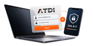
We are strengthening our CRM security by introducing two-factor authentication (2FA).
Starting in October, users will see an additional security check when accessing their CRM account. Along with their existing username and password, users will be asked to verify their identity using a unique six-digit code sent to the email address registered to their account.
Your existing username and password will remain unchanged, and you don't need to take any action before the update. We do, however, recommend confirming that you can access the email address associated with your CRM account. For any queries, please contact us directly at contact@atdi-group.com

Comms Connect 2026 – 14-15 October – Melbourne, Australia – Comms Connect brings together professionals from public safety, utilities, mining, transport, government and industry to explore the latest developments in critical communications. Meet the ATDI team to see how HTZ Communications supports mission-critical networks through coverage prediction, network planning, interference analysis and spectrum engineering across DMR, TETRA, LTE, 5G, microwave and Wi-Fi.
Find out more about Comms Connect 2026
IMARC 2026 – 27-29 October – ICC Sydney, Australia – Reliable wireless connectivity is fundamental to modern mining operations. Meet ATDI at IMARC to discover how HTZ Communications supports private LTE/5G, Wi-Fi, TETRA, DMR and point-to-point networks across complex and changing mining environments. See how advanced terrain modelling, coverage and interference analysis, site selection and automation support the planning and optimisation of mining communications.
Find out more about IMARC 2026
NATO Future Land Forces 2026 – 3-5 November – Warsaw, Poland – ATDI will exhibit at Future Land Forces, bringing together military, government, and industry specialists focused on evolving land-force requirements and emerging defence technologies. Our team will also deliver a technical briefing on Tuesday 3 November, demonstrating how advanced RF modelling supports spectrum situational awareness, interference and jamming analysis, network coverage and resilient communications in complex operational environments.
As demand for effective spectrum management and electromagnetic operations continues to rise, this is an important opportunity to see ATDI’s latest defence capabilities in action. Visit our exhibition space, meet our specialists and discuss how our solutions support current operational spectrum challenges.
Attending Future Land Forces? Contact us in advance to arrange a meeting at the exhibition or book a demonstration with the ATDI team.
Future Land Forces 2026 – arrange a meeting or demo