Is the aviation industry finally playing catch up with new use cases for 5G? Recent developments show traditional air to ground stations (A2G) are being used for private 4G/5G networks that offer an infinite number of new applications. To support developments in the aviation industry, HTZ now features a flight-tracking function. This models the flight path of a mobile (either an aircraft, drone - UAV/UAS or high-altitude platform - HAPS). This function accounts for the altitude, roll, pitch and heading of the aircraft, and analyses its impact on the DL/UL (thresholds) connections and/or the interference between ground stations and the mobile.
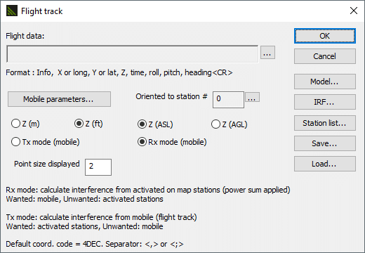
Generally, A2G networks are deployed for civilian organisations like civil aviation organisations and airports to maintain reliable radio comms between air traffic controllers and the aircraft. HTZ analyses communications with the aircraft throughout the flight phase, including during the take-off and landing, where pitch and roll are prominent. It also models high-altitude platforms whose performance is impaired by strong winds as a result of the high elevations. Analysis of potential interference from mobile to other ground stations is undertaken. The aircraft antenna patterns are modelled in 3D and with the automatic adjustment to the azimuth of the mobile’s antenna according to the 3D path (altitude, roll pitch or heading) of the aircraft along its route.

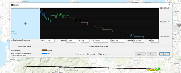
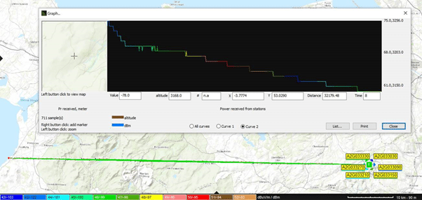
Analysis of the DL/UL connections between LTE A2G stations and an aircraft can be tracked at different altitudes, with the threshold results displayed on a graph. Similarly, the DL threshold can be analysed from the A2G station into the mobile with the power received (power sum) from the aircraft into the LTE station displayed at different positions of the mobile.
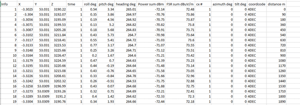
The output from this analysis is an Excel table with the roll, pitch, heading and antenna azimuth values for the mobile analysed at different positions.
Current use cases being tested include:
To arrange a demo or online meeting, contact us today.


