This month's newsletter covers the latest updates in HTZ and the ATDI cartographic library.
Our product spotlight introduces the GNSS-CRPA Jamming map function in HTZ Warfare, which enables users to plan jamming deployments and ensure uninterrupted GPS reception by estimating the enemy's jamming capacity. Watch the video demo of this exciting new function. Link:
Our customer focus highlights Hong Kong-based aviation consultants, Lacle who acquired HTZ to enhance aviation services, for airport planning and critical communications system reliability.
Missed our latest webinar. Catch up with the webinar recording and explore how to create reliable radio network coverage in challenging mining environments. It delves into the best practices employed by global mining operators to design and manage their networks efficiently.
Lastly, join us at some of the leading industry exhibitions this month. Check out our Events section to see where you can meet the ATDI team.
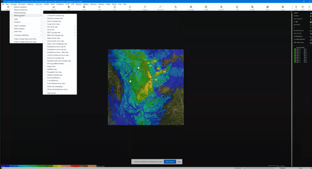
Explore the new features in this month's release: HTZ v.2024.4. Users can access the latest release through the customer portal.
CRPA coverage: CEW / Jamming / Static / Jammer CRPA coverage – enabling GNSS receiver on UAVs to be jammed. This function also supports anti-jamming capabilities on the UAV. Based on feedback from the battlefield, this function allows users to plan jamming deployments to counter enemy tactics, as well ensuring uninterrupted GPS reception by estimating the enemy’s GPS jamming capacity. For full details, see this month’s Product Feature and video.
Interface + Reports: Vector Path: dynamic access (mouse) added, including settings per segment if anchor (All) is activated. Able to view additional information.
SQL tables: increased the number of info fields in Station X64 and for stations and MWX64 for MW links. Increased limit to 30 characters.
Shortcut: to isolate sites.
Location file update: new information added to ‘location to site code’, plus the ability to update the site name and the coordinates, state, country etc.
Clutter classes: snow/ice clutter classes can be replaced by building wood, which adds additional flexibility to redefine clutter classes, as required.
User palette: now considers up to 256 colours for best server maps.
Station label: <F5> key – If a black background is chosen the label becomes transparent to avoid hiding results behind the label.
Simultaneous coverage: Analyses of overlap area, where different servers are received within a given range. This improves the display and allows site-by-site analysis of the percentage of best server overlap from two up to 10 overlapping orders.
Set NOAA forecast: Mouse - right-click on the map - to update the corresponding parameter in a simulation including the addition of the temperature, wave heights, rain rate or wind speed on the map.
Export Google Earth: Added ‘Add comment field’ to site by site or composite coverage option when exporting to a .kml or .kmz file.
Path Objects: Path parameter box added in station tree view (right bar).
Map data downloads: able to create a text file with URLs for map data downloads.
Indoor planning:
Fill/ Modify altitude (right click on map)from triangle mesh (3DFACE objects). This function imports the .dxf containing the 3DFACE triangle objects and modifies the DTM layer. 3DFACE object contains X Y, and Z for every vertex. Point elevation is calculated from Z vertices.
Fill / Modify altitude (right click on the map)from STL triangles (binary format) to import STL binary files containing triangle objects and to modify the DTM/IDR layer.
Correlation of Generic and Import generic: import format ProMax (.CSV) added, converting ProMax CSV to Generic X, Y, Value (.dlm) format. Used for measurements like power received etc.
Coverage: Network planning / SFN delay assignment is replaced by a default algorithm ensuring calculations use the faster method.
Propagation model: 452-18 replaces 452-17.
Propagation model: tuning the subpath - Fresnel Zone (FZ) fraction can now be applied.
Propagation model: correlation and tuning: vector polygon mask added.
Building entry loss: able to enter user-defined building entry losses for concrete, glass, plaster and wood building classes. Also, an option to add dB/km clutter options to support different building materials when crossing from one building to another.
Propagation model: when reviewing updated models like 452, 1812 and 526 which consider the Delta Bullington method, the modelling across each model differs and can lead to inconsistent results. A default has been applied to analyse the path from the next point from the transmitter to the last one before the receiver.
Mobile: Multipoint / Interference / 4G/5G connections: access to report SNIR/RSSI/RSRP between activated stations to analyse and report on 4G/5G interference between stations.
Station list: RS boost added (if > 0).
5G Numerology: Numerology 6 was added to support a wider bandwidth up to 2 GHz.
Import/Export MW link: .txt format removed. Use .ewx or import generic or MW X64 table instead.
Rest API: HTZ Communications now connects to HTZ Web API service, previously only available with HTZ Warfare.
Check out the latest cartographic datasets released. These royalty-free datasets are a valuable addition to your cartographic toolkit and are accessible to the customer portal. Here's a summary of the data resolutions and their locations:
1m resolution – DTM/Clutter/Buildings: Marseille, France. Hallered, Sweden.
2m resolution – DTM/Clutter/Buildings: Magdeburg, Germany. Tampere, Finland. Boras + Karlskrona, Sweden.
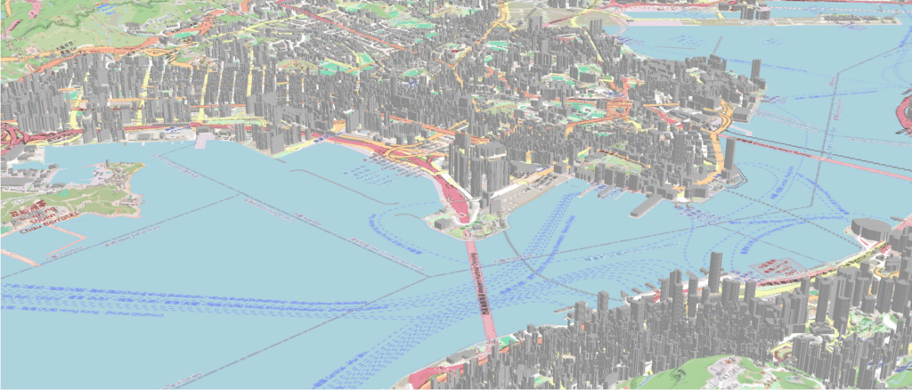
2.5m resolution – DTM/Clutter/Buildings: Hong Kong
We continually refresh our map data library to guarantee your access to the most current maps. Stay tuned for updates!
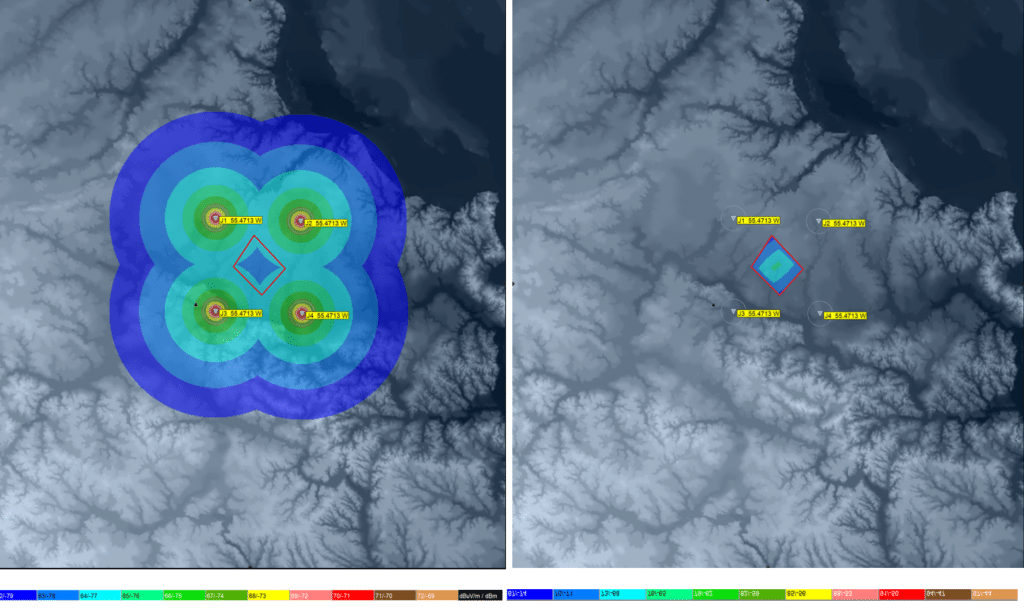
Jamming GPS signals is an efficient tactic to constrain enemy forces. Controlled Radiation Pattern Antennas (CRPAs) counter anti-GNSS jamming through beamforming. ATDI introduces a "GNSS-CRPA Jamming map" function to HTZ Warfare for planning deployments and ensuring uninterrupted GPS reception.
To ensure effective jamming, more jammers than CRPA elements are needed. The GNSS receiver configuration manages all elements including spacing, beamwidth, gain, thresholds, frequency, height, and jamming thresholds. The jammer settings include distance limits, composite coverage options, and signal rejection criteria.
HTZ applies two methods for calculating jammer coverage: one for automatic NULL steering and the second for customisable resistance. The outputs show jammed points, rendering CRPA reception and GNSS signal reception impossible.
To read the full article on this innovative new feature in HTZ, click here.

Hong Kong-based aviation consultancy firm, Lacle recently acquired HTZ Communications to support business development and enhance its services to the aviation sector. The Lacle team specialises in several sectors including airport safeguarding, control tower and CNS (communication, navigation, and surveillance) siting planning, and airport and airspace design assessments.
Using HTZ, Lacle conducts comprehensive CNS assessments and modelling to ensure the reliability and security of critical safety systems to potential interference. This type of analysis includes signal coverage field strength modelling, GPS coverage evaluation, and path profile analysis. They also proactively manage the impacts posed by external factors such as wind farms and construction equipment on sensitive CNS infrastructure. HTZ is ICAO compliant, allowing for the precise modelling of CNS signals, and aiding with the assessment of potential impacts from new developments or structures in the vicinity of the airfield.
HTZ analyses the impact of proposed developments on airport communications, including surveillance radars and sensors for ground and airspace operations, VHF Comms, and ILS (instrument landing system) stations. This type of obstacle assessment empowers airport authorities and local planning bodies to implement necessary restrictions or mitigation measures to minimise adverse impacts of interference on these critical comms networks.
HTZ is an essential toolkit for air navigation and airport service providers across the globe to assess ground-to-ground, ground-to-air and air-to-air communications services.
Did you miss our latest webinar? Catch up with the webinar recording.
This webinar explores how to create reliable radio network coverage in challenging mining environments. It delves into the best practices employed by global mining operators to design and manage their networks efficiently.
Learn more about our flagship RF planning software, HTZ Communications and acquire practical insights and strategies from our industry experts.

AOC Europe, Oslo, 13-15 May – This event connects Government, Defence, industry, and academia to showcase the latest EW and defence industry advances. ATDI will demonstrate their battlespace spectrum management solutions at Stand E50.
Critical Comms World, Dubai, 14-16 May – This premier public safety event brings together mission-critical end users and manufacturers for three days of inspiration, knowledge sharing, and networking. Visit the team at Stand I31 to explore the latest developments in managing radio networks in this demanding domain.
ISNR, Dubai, 21-23 May – This prominent military event focuses on new technologies for countering escalating threats in the defence and security sectors. The ATDI team will showcase their flagship technical analysis tool, HTZ Warfare, at Stand 09-B41. Visit us to explore how we can assist you further.
CommunicAsia, Singapore, 29-31 May – ATDI will exhibit at this regional flagship event, gathering service providers, regulators, vendors, and system integrators to discuss industry advancements. Our team will showcase a cutting-edge radio planning solution tailored for spectrum engineering and technical analysis.


