This year we’ve risen to the challenges of technological change, benefitted from R&D developments and collaborated across the ATDI Group. By pooling resources and expertise across the group, we offer end users added value and improved support services.
This is the last Newsletter for 2022 and we're covering the latest HTZ upgrade, containing numerous new and updated features for users. We also review ICS Portal, our web-based solution for viewing network coverage. ICS Portal is a modular solution that allows network coverage to be shared flexibly and securely, allowing users to understand the impact of network downtime and network not-spots.
With 2023 in our sights, we've scheduled our next Spectrum Management summit in February. This event will run over two half-days focusing on military and civil spectrum management. To register interest, contact us today.
Best regards from
The ATDI team
This month sees the release of a series of features to HTZ. This upgrade is available to users with a valid maintenance contract, version 2022.12 is available to download via the CRM. For any questions relating to the upgrade or new functionality, please contact support@atdi-group.com.
Propagation models – sees Deygout 94 display the distance of a path in a MW link list.
Parameters and calculations – sees modifications to the interference rules for Collision: start/end dates. A black/white option has been added to View display for station parameters. The ability to open multiple sessions of HTZ to compute coverage by groups of stations in parallel. And, for localization, the AOA mode considers DF accuracy when the NLOS is greater than the sensor-measured LOS.
GIS data support – features the ability to create blank matrices for rectangle selection with a comment field of the corresponding vector. The ability to create vector files from an address file. Ability to add polygon contours to modify clutter with SHP polygons. Improvements have been made to LiDAR data conversion including speed of conversion. And, new cartographic grids have been added including Canada Lambert and GRIB global. NOAA display allows users to download the latest forecasts; for HTZW users, the MaXar satellite image layer has been enhanced.
Satellites – sees Link availability statistics consider the presence of clouds with an increase in sampling from one to three hours.
Microwave – introduces Path distance displayed to the MW link list and adds it to the CSV report. An updated launch delay (TOA) option has been added for P2P and P2MP.
Broadcast – sees SFN launch delay assignment featuring support for linked Gap fillers. An AM button has been added to compute the Tx add losses to AM ground system correction factors for the FCC. And, regional DAB coordination now considers AGCOM (Italy) rules for national and international test points.
Windfarms – Ability to add a virtual wind turbine on each point of the map around each transmitter and within a limited radius.
CCTV - A vertical angle can now be set between +/- 90°.
For access to these features and other new and updated ones, please visit the customer CRM for the latest modifications file and upgrade.
View the PPT slides for the upgrade, here.
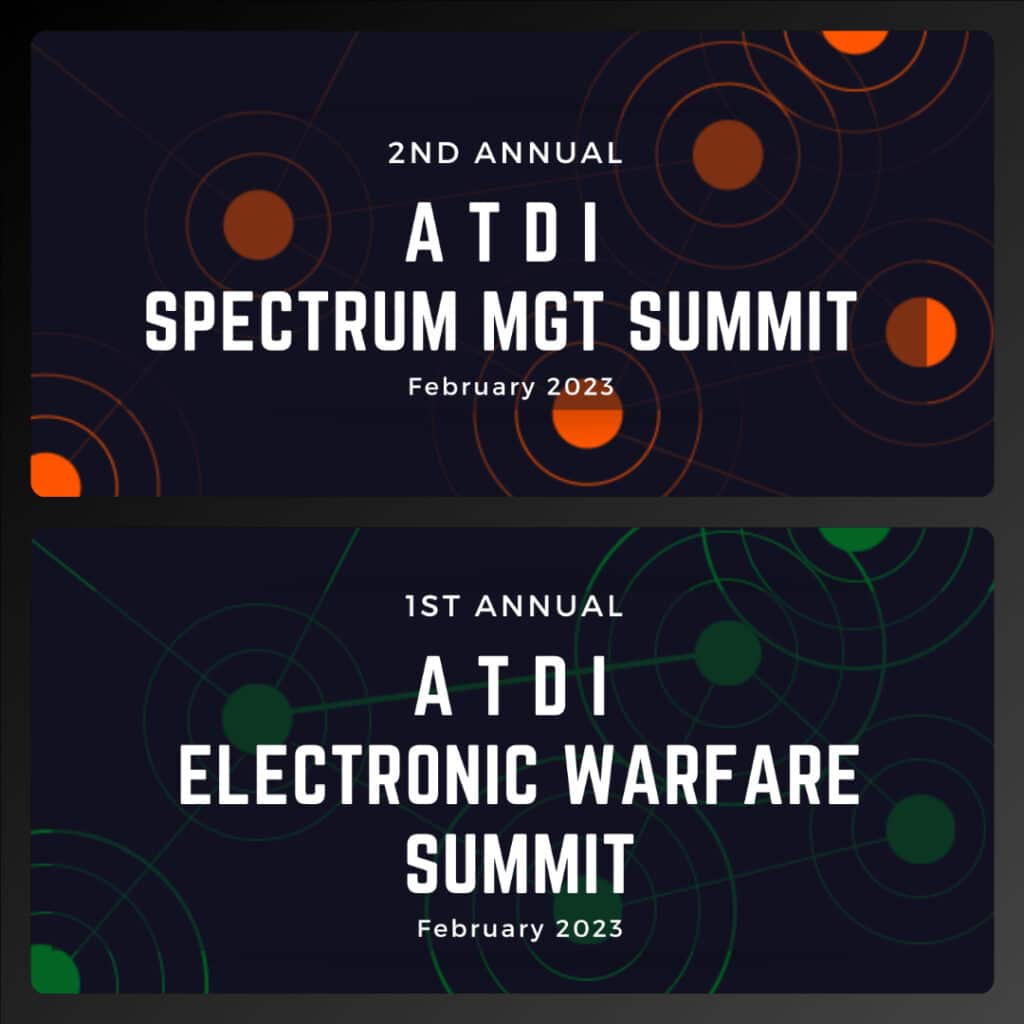
ATDI hosts its second annual Spectrum Management Summit. This event will present two half-day events focussing on civil spectrum management and military spectrum regulators. The event is scheduled for February 2023 and will look at topical industry issues on spectrum management and introduce the latest solutions developed by ATDI and their solution partners.
After an incredibly successful launch last year, this online Summit enables industry personnel, customers and partners, to join from across the globe. Full details of the program and an opportunity to register will be released in January. Watch this space.
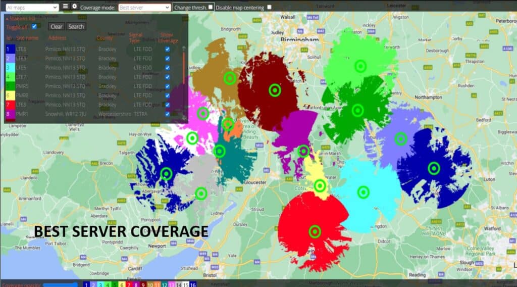
Access to real-time mobile network coverage allows control centres and network service teams to identify coverage not-spots quickly. So whether that’s when sites go down or to help identify black spots in extended service areas, ATDI provides an off-the-shelf coverage-sharing solution that allows internal and external stakeholders to access the latest network information.
ICS Portal is a modular solution that allows network coverage to be shared flexibly and securely. Users can view composite and best server coverage for a given area and turn sites on/off sites to understand the impact of lost stations or to manage network coverage during maintenance. ICS Portal offers a filter function that can identify the signal type and/or geographic regions. Combined with a ‘toggle all’ function, these features allow users to turn on/off all stations based on selected criteria.
In addition, coverage can be viewed by changing the threshold values. Controlled by the site admin, this function can be restricted according to user profiles. Similarly, the admin can restrict user viewing options, applying preset values to dynamically display changes on the map depending on the threshold value. Threshold values are displayed in dBm or dBµV /m, automatically accounting for the station frequencies.
ICS Portal is fully compatible with HTZ and offers custom features enabling users to adapt the colour palette, view MW links, and display their profiles and station parameters. Users can define the map sources along with customised marker properties, ensuring that each and every customer benefits from a unique user experience.
The platform has access control by user authentication and runs on either a private server for internal use only or a service over the secured cloud server.
View our product demo today. For more information or to request a demo, contact us today.
Last call for ICS Telecom users to upgrade free of charge to HTZ Communication.
HTZ Communications is a direct upgrade from ICS Telecom and supports advanced radio network planning and optimisation capabilities for almost every technology. Users will benefit from a wealth of new and improved features, as well as improvement to the user interface, with all project files upward compatible with HTZ.
ICS Telecom was discontinued in 2019 and replaced by HTZ. Users with a valid maintenance contract will receive an automatic upgrade. This offer is open to all ICS Telecom users enabling them to access the latest propagation models, a royalty-free map data library and benefit from the improved user experience.
This offer ends on 31 December 2022. To renew your annual maintenance contact us for a quote today.
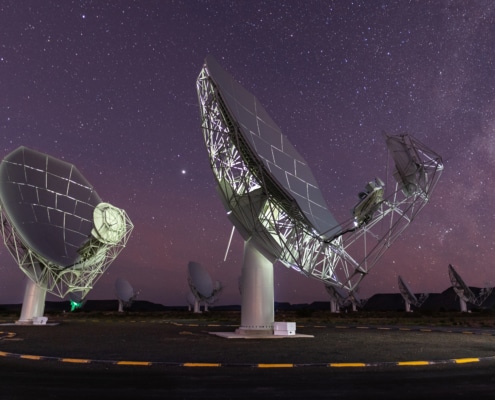
Projects at Stellenbosch University in South Africa are given a helping hand from ATDI’s flagship RF modelling software, HTZ Communications. Teams at the University plan to use the software across different studies. These projects include interference analysis for radio telescopes, radio propagation modelling, sensor networks and advanced wildlife tracking methods.
Radio Telescopes
RF interference is a known problem for radio telescope receivers. Transmitters emitting signals at frequencies in bands assigned to the radio astronomy band can cause interference and loss of information. This occurs when the transmitter’s output is too high for the radio astronomy band, or when the transmitter emits frequencies outside its intended range.
Using HTZ Communications, the University models the influence of potential interferers and offers mitigation techniques, like:
- Frequency re-allocation and equipment choice revisions;
- Interfering site optimisation, making adjustments to power, tilt, azimuth, antenna patterns etc.
Studies are also undertaken on the accuracy of radio propagation prediction itself, focussing on the extent of the telescope area and its topography. The University has a continuing interest in different projects relating to the telescope array. For more information visit www.ska.ac.za.
High-Tech Agriculture Sensors
Technology developments in the agriculture industry aren’t new, but researchers at Stellenbosch University are involved in the optimisation of natural resource utilisation in the viticulture domain. With Stellenbosch renowned for its wineries, growers want to understand how they can use wireless sensor networks to collect essential data like soil moisture and measure other climatic conditions. The research is being undertaken with the French national research institute INRIA and focuses on the sustainability of limited available resources like water for irrigation.
The wireless-based sensors are located close to the ground and are impacted by the seasonal vineyard canopy making connectivity difficult. Using HTZ, students can model and optimise the sensor network to ensure reliable data transmission. The modelling of the cartographic environment with ground obstacles, vegetation height and other constructions (sheds, silos, etc) and accurate propagation models, enable them to determine the expected sensor coverage with optimum sensor placement as required.
Tracking Wildlife
The lack of wireless connectivity in the bush makes it hard to track endangered species like Rhino. Radio tracking devices are used across the globe to track and monitor rare and endangered species and at Stellenbosch they have been modelling associated radio signal strength predictions, taking into account animal physiology and their habitat. The aim is to improve the location accuracy of such devices to enable the local game reserves to protect and manage their wildlife.
HTZ displays information from the sensors directly on a map for subsequent analysis. In areas where no sensor coverage is predicted, HTZ helps to find additional locations for the data collection network to fill the coverage gaps.

Professor Riaan Wolhuter, Associate Profession for the DSP-Telecommunications at Stellenbosch, says, “For the communications-related research work we are involved in, a reliable radio propagation planning tool such as HTZ is essential. Not only for basic analytical purposes but also as a reference against which to compare results of investigations into specific dedicated propagation models.”
HTZ Communications – Academic licenses Full details of the license packs contact us today.

Spectrum sharing takes many forms with countless organisations looking for inventive ways to maximise the use of this vital resource. But in South Africa, the military is also looking to share its spectrum management tools. Branches of the army will give access to their RF Engineering tool, HTZ Warfare to users from the air and sea to support tactical military networks both nationally and internationally.
While each unit of the armed forces has unique uses for HTZ Warfare, it makes perfect sense to share this essential software. For example, the land Army currently uses HTZ to manage microwave links, HF and UHF/VHF comms. While the Navy plan to use it to assess the likelihood of potential interference with radars. These studies vary from analysing the impact of a new broadcast or mobile base station to mitigating the impact of MW links located near the radar. The Airforce plan to use it to optimise the flight paths for drones and other aircraft trajectories.
HTZ Warfare models all radio communications technologies between 8KHz and 1 THz. It exploits spectrum-dependent systems making it inherently suited for all areas of military and civil use.
To arrange a demo or to discuss our licensing models, contact us today.


