This edition brings some exciting news for our users. Over the summer, we released a significant update to our map data library, delivering richer, high-resolution datasets that significantly improve the accuracy and reliability of your planning projects. This update is a core value of the Maintenance Contract, ensuring you always have access to the very latest geospatial resources.
Alongside this, we’ve released new HTZ functions, including enhanced propagation modelling and updated MIMO array rejection calculations, delivering greater precision and efficiency in your workflows.
We’re also pleased to share three new electronic warfare video demonstrations: drone-mounted direction-finding using TDOA and AOA techniques, on-the-move jamming simulations, and MANET communications planning with automated optimisation.
Finally, ATDI will be exhibiting at several key events before the end of the year, including the UIC FRMCS Global Conference (Rail), MWC Las Vegas (Mobile), Comms Connect Melbourne (Mission Critical), and Saudi Rail 2025. We look forward to engaging with industry professionals across these diverse sectors.
From the ATDI team.
HTZ continues to evolve, with new features and modifications designed to enhance the user experience, improve RF analysis capabilities, and support critical spectrum management tasks.
Feature Enhancements Overview
Modify Clutter with SHP Points
Now adds only vegetation clutter codes based on point height (PointZ or DBF attribute). Codes created are 14, 8, and 5, depending on vegetation height.
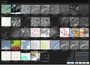
Map Layer (F4) Update
The “OSM transport” server has been replaced by OSM Cycl, now including contour lines for enhanced map detail and usability.
Path Object – Variable Elevation
New option: Variable elevation (oblique flight) interpolates mobile height between waypoints. The previous option is now labelled “Variable elevation (horizontal flight).”
5G Station Parameters – gNB Tab
Overhead (%SS/PBCH) and xPDSCH values are now calculated automatically based on the frequency in use (FR1/FR2), as specified in 3GPP.
Export PNG Tiles with AI Mask Prediction
Now checks for existing clutter codes before downloading tiles, reducing redundant processing and improving performance in “whole project” mode.
MIMO Array Rejection (Modified Calculation)
Interference rejection is now calculated differently depending on antenna type and MIMO scheme, ensuring more accurate modelling of real-world scenarios
Command Line Interface
A new action code generates availability maps, providing detailed ASCII outputs on available and contiguous channels for faster spectrum analysis.
Propagation Model Update (ITU-R P.368-9)
Improvements to the GRWAVE model eliminates discontinuities when transitioning between different conductivity areas, resulting in smoother and more accurate propagation results.
Adaptive MIMO Switching
The Adaptive MIMO Switching (AAS) mode has been removed from SNIR and throughput calculations. Results now rely on station-defined parameters for arrays, layers, and MU.
Vector Layer Selection
Users can now filter vectors by string fields in “exact” or “contain” modes, improving map/vector data handling flexibility.
Subscriber Parameters Update
A new “Layers” parameter has been introduced for subscribers, enhancing accuracy in MIMO rejection and throughput calculations.
MIMO Array Rejection Calculations
Rejection is now consistently computed as Tx + Rx rejection, reflecting transmitter/receiver setup more precisely across stations, subscribers, and map points.

Explore the latest cartographic datasets now available. These royalty-free datasets are a valuable addition to your cartographic toolkit and are accessible through the customer portal. Here's a summary of the data resolutions and their locations:
1m resolution: DTM/Clutter/Buildings: Germany: Weisswasser. France: Cosne-Cours-Sur-Loire, Tours, Poland: Skierniewice. Estonia: Tartu, Uusna. Germany: Starnberg.
2m resolution: DTM/Clutter/Buildings: USA: Sacramento, Los Angeles. Iceland: Reykjavik.
2m resolution: Population: Hong Kong.
2.5m resolution: DTM/Cutter/Buildings: Japan: Hiroshima.
3m resolution: DTM/Clutter/Buildings: USA: Eastern Bay (MD).
5m resolution: DTM/Clutter/Buildings: Jeddah + Riyadh, SA. Estonia.
10m resolution: DTM/Clutter/Buildings: Iceland. Israel. Germany: Rheinland-Pfalz.
10m resolution: DTM/Clutter: Japan.
20m resolution: DTM/Clutter: Saudi Arabia, Congo, India: Andhra Pradesh, Arunachal Pradesh, Assam, Bihar, Chhattisgarh, West Bengal, Vijayawada, Uttaranchal, Tripura, Sikkim, Tamil Nadu, Rajasthan, Punjab, Orissa, Nagaland, Mizoram, Meghalaya, Manipur, Maharashtra, Madhya Pradesh, Karnataka, Kerala, Jharhand, Himachal Padesh, Haryana, Gujarat. Iraq. Syria.
30m resolution: DTM/Clutter: Japan: Southern Islands,
100m population: Japan, 2020.
We continually refresh our map data library to guarantee your access to the most current maps. Stay tuned for updates!

We are proud to share that ATDI’s Group Director, Agnieszka Słósarska, accepted the Golden Cyborg Award on behalf of ATDI at the Gala ceremony held on 10 September, organised by the Polish Academy of Sciences.
This prestigious award honours leaders in teleinformatics and was presented for outstanding contributions to the promotion of ‘new media and the development of radio network planning and optimisation’.
For over three decades, ATDI has been at the forefront of spectrum management and network planning innovation. Receiving this recognition underscores our continued role in advancing telecommunication technologies and supporting industries worldwide in building efficient, resilient, and future-ready networks.
 Next Generation Tools for the Modern Battlespace
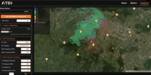
Explore how automation is reshaping spectrum operations. These short videos show HTZ in action, streamlining MANET planning, optimising jamming strategies, and enhancing direction-finding missions. Each video highlights real-world scenarios where automation saves time, improves accuracy, and delivers mission-ready insights. Whether you’re focused on tactical communications, electronic warfare, or situational awareness, these demos reveal practical solutions designed for demanding operational environments.
Watch now to see how advanced API workflows can transform your spectrum strategies.
HTZ Web API – On-the-move comms and link analysis
See how automation transforms MANET planning. This demo shows how HTZ streamlines survey data, coverage modelling, and optimisation to deliver reliable, mission-ready tactical communications—faster and with greater accuracy.
HTZ Web API – On-the-move jamming simulations and analysis
Learn how automated workflows simplify jamming mission planning. Watch HTZ simulate mobile jammer deployments, evaluate effectiveness, and provide real-time insights for smarter, faster operational decisions.
HTZ Web API - Drone-mounted Direction Finders for ground-based target detection
Discover how HTZ enhances direction-finding missions. This demo explores automated geolocation accuracy, DF asset configuration, and real-time analysis for superior situational awareness.

UIC FRMCS Global Conference – 14–15 October, Paris
ATDI showcases advanced RF planning tools to support FRMCS migration, covering coexistence, cross-border coordination, tunnel coverage, and capacity forecasting. Join us to explore future-ready railway communications.
MWC Las Vegas 2025 – 14–15 October, Fontainebleau Las Vegas
ATDI presents advanced RF planning solutions for 4G and 5G, demonstrating coverage prediction, interference management, frequency planning, and consultancy services to future-proof mobile networks.
Comms Connect Melbourne 2025 – 16–17 October, Melbourne
ATDI showcases advanced RF planning for mission-critical communications, supporting DMR, TETRA, LTE, and 5G with coexistence analysis, multi-technology simulation, and real-time coverage optimisation.
Saudi Rail 2025 – 19–20 October, Riyadh Front Exhibition & Conference Centre
ATDI demonstrates advanced RF planning for railway telecoms, covering GSM-R, FRMCS, and LTE with tunnel modelling, interference mitigation, and lifecycle optimisation for mission-critical networks.


