Projects at Stellenbosch University in South Africa are given a helping hand from ATDI’s flagship RF modelling software, HTZ Communications. Teams at the University plan to use the software across different studies. These projects include interference analysis for radio telescopes, radio propagation modelling, sensor networks and advanced wildlife tracking methods.
Radio Telescopes
RF interference is a known problem for radio telescope receivers. Transmitters emitting signals at frequencies in bands assigned to the radio astronomy band can cause interference and loss of information. This occurs when the transmitter’s output is too high for the radio astronomy band, or when the transmitter emits frequencies outside its intended range.
Using HTZ Communications, the University models the influence of potential interferers and offers mitigation techniques, like:
- Frequency re-allocation and equipment choice revisions;
- Interfering site optimisation, making adjustments to power, tilt, azimuth, antenna patterns etc.

Studies are also undertaken on the accuracy of radio propagation prediction itself, focussing on the extent of the telescope area and its topography. The University has a continuing interest in different projects relating to the telescope array. For more information visit www.ska.ac.za.
High-Tech Agriculture Sensors
Technology developments in the agriculture industry aren’t new, but researchers at Stellenbosch University are involved in the optimisation of natural resource utilisation in the viticulture domain. With Stellenbosch renowned for its wineries, growers want to understand how they can use wireless sensor networks to collect essential data like soil moisture and measure other climatic conditions. The research is being undertaken with the French national research institute INRIA and focuses on the sustainability of limited available resources like water for irrigation.
The wireless-based sensors are located close to the ground and are impacted by the seasonal vineyard canopy making connectivity difficult. Using HTZ, students can model and optimise the sensor network to ensure reliable data transmission. The modelling of the cartographic environment with ground obstacles, vegetation height and other constructions (sheds, silos, etc) and accurate propagation models, enable them to determine the expected sensor coverage with optimum sensor placement as required.
Tracking Wildlife
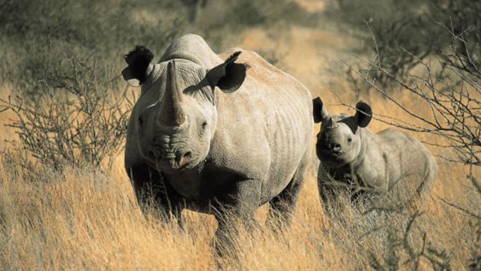
The lack of wireless connectivity in the bush makes it hard to track endangered species like Rhino. Radio tracking devices are used across the globe to track and monitor rare and endangered species and at Stellenbosch they have been modelling associated radio signal strength predictions, taking into account animal physiology and their habitat. The aim is to improve the location accuracy of such devices to enable the local game reserves to protect and manage their wildlife.
HTZ displays information from the sensors directly on a map for subsequent analysis. In areas where no sensor coverage is predicted, HTZ helps to find additional locations for the data collection network to fill the coverage gaps.

Professor Riaan Wolhuter, Associate Profession for the DSP-Telecommunications at Stellenbosch, says, “For the communications-related research work we are involved in, a reliable radio propagation planning tool such as HTZ is essential. Not only for basic analytical purposes but also as a reference against which to compare results of investigations into specific dedicated propagation models.”
HTZ Communications – Academic licenses
For full details of the license packs available for Universities and research organisations, contact us today.


