As the demand for satellite networks grows, so too does increased interference. This risk is further amplified if the network isn’t planned, coordinated and executed properly. Satellite operators face different types of coverage and interference threats daily. Managing those risks is key to ensuring a full satellite service.
Over a series of three articles, we look at some of the issues facing satellite operators in today’s highly congested airways.
Our first article covers MW Link interference.
MW link interference
A national regulator turned to ATDI to model and mitigate interference between earth stations and P2P links. A satellite earth station operator, who worked on a receive-only basis in the 11GHZ band using a license-exempt basis spectrum, suffered interference from a MW link in the same band. To secure protection for users in this shared band, the regulator needed to model how the MW link impacted satellite coverage.
When an Earth station connects to an NGSO satellite or a constellation, the orientation of its antenna will follow the satellite/s tracks. Modelling this behaviour uses beamforming antennas with Beam Steering range (BSR) and step parameters defined in the Earth station parameters. The sequence below walks through how this is achieved.
- Step 1: set up the main antenna diagram taking into account the azimuth and tilt pointing towards the middle of the antenna variation range. The example below shows when the elevation angle is fixed (27°), the azimuth varies between 154° and 162°. The middle of the arc is 158°:

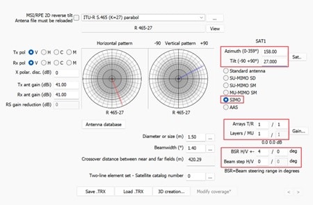
- Step 4: When the Beam steps H/V is set to 0, the antenna will automatically point to the exact direction of the receiving point when the station is transmitting, or in the exact direction of the transmitter considered (interferer) if the station is receiving. NB. within the limits of the range of angles (blocking at the maximum, if exceeded). If a step is defined (ie, 1°), the direction closest to the receiver or the interferer within 1° range is considered for calculations.
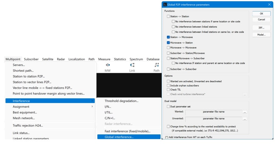
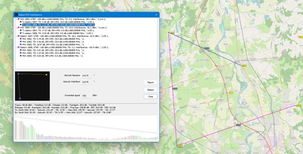
The next stage would look at P2P interference between the Earth station and the MW links, supported by the Global interference feature - Stations vs. Stations and Stations vs. MW links:
To support this requirement, ATDI provided a comprehensive training course which aimed to demonstrate how to reduce the likelihood of further interference moving forward. The training included:
ATDI also provided a demo to show how ICS Manager, ATDI’s database management solutions builds coordination contours for Earth stations and extracts the MW links and other stations from within the coordination area.


