Explore the latest product updates and customer stories in this month’s Newsletter.
Welcome to the February edition which unveils the latest new and improved features in HTZ and the map data releases. Our lead feature spotlights how South Korea-based provider Solvit Systems is revolutionizing search and rescue. This solution harnesses the power of 4G/5G networks and drones to improve rescue rates in areas with restricted network coverage with the support of HTZ and the HTZ Web API. We also highlight how a European MNO leverages HTZ to optimise network coverage and improve capacity and the latest updates from the Polish GSM-R rollout.
Don’t miss out on our upcoming webinar. Register today to learn about establishing reliable radio network coverage in challenging mining environments. This event delves into the best practices employed by global mining operators to design and manage their networks efficiently. Can’t attend? Register to receive the recording after the event.
Wishing you a great day. From the ATDI team.
Explore the new features in this month's release: HTZ v.2024.2. Users can access the latest release through the customer portal.
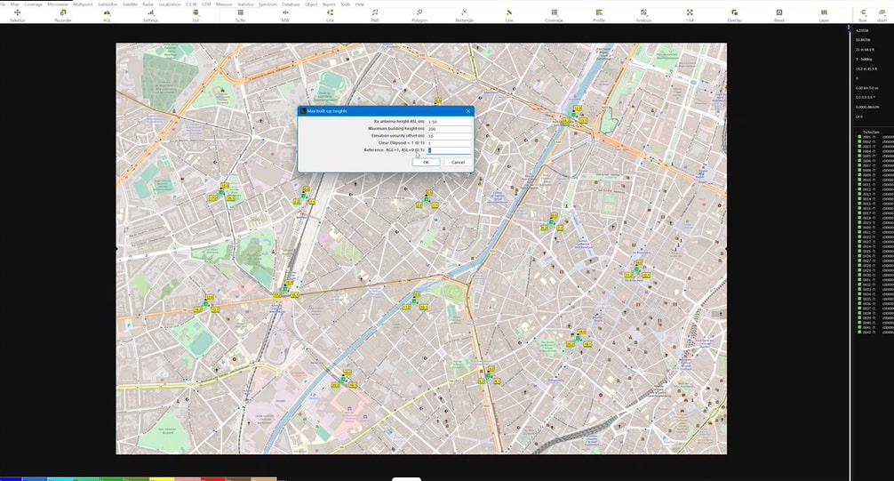
INTERFACE - Subpath attenuation tuning: the subpath methods for the Current model, Standard, Coarse, Fine, Area & Fresnel are now tested, with a ‘preview current model’ function added to check the correlation results with the current propagation model.
Updating location file: ability to import additional fields into Tx/Rx objects, MW links or subscribers including address/state/country/city and zip code.
Correlation and Tuning: a ‘use vector polygon (s) as a mask’ replaces the ‘import exclusion filter (.PLG)’. When checked, the measures located in the polygon won’t be used during correlation or tuning.
Station pop-up menu: an ‘isolate site <i>’ option has been added to isolate all stations collocated with the selected station. The <i> short key replicates this when pressed over a given station.
SQL tables: text fields have been extended to 30 characters in HTZ and exchange tables for Stationx64 (INFO1, INFO2 and NETID) and MWx64 (NetidA, NetidB, Tx_info1, Rx_info1, Tx_info2 and Rx_info2).
Vector path: click on a given ‘vector path' waypoint for the settings of the corresponding segment. If the "All anchors" display option is selected in the Preferences, the properties of the segment are listed in the legend bar. Click the legend bar to modify the vector properties.
ProMax format: the import of ProMax format (CSV) has been added. This import converts the ProMax CSV file to an equivalent file in a generic format (X; Y; Pr (dBm)).
CALCULATIONS - Tuning/Subpath methods: the ‘FZ fraction from 0.2 to 1 applied’ option tests for an FZ fraction varying from 0.2 to 1 with the Standard, Fine and Fresnel subpath methods.
PROPAGATION - ITU-R P.452: The ITU-R P.452-18 release has been implemented.
NB. Due to the new way the clutter obstacles are considered, huge differences might appear between the results provided by both releases.
MOBILE - Multipoint/interference - 4G/5G T/R connections: This feature will provide a report containing: Broadband cell power (dBm), RSSI (dBm), RSRP (dBm), RSRQ (dB), SNIR PDSCH (dB), Gain (dB), SNIR PDCCH (dB), SNIR PBCH (dB), Max throughput DL (kbps), Distance (m) and ToA (µs) between activated stations.
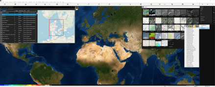
Check out the latest cartographic datasets released. These royalty-free datasets are a valuable addition to your cartographic toolkit and are accessible to the customer portal. Here's a summary of the data resolutions and their locations:
1m resolution – DTM/Clutter/Buildings: Newcastle - UK, Port Isabel (TX) - USA, Charleroi/Namur/Kortrijk/Leuven/Liege/Mons/Tournai/Brussels/Antwerpen/Brugge/Hasselt/Ghent – Belgium.
10m resolution – DTM/Clutter/Buildings: Israel, Ireland.
20m resolution - DTM/Clutter/Buildings: Calgary - Canada, Azerbaijan.
50m resolution – Population: France, Italy.
90m resolution – Population: Italy (population raster).
100m resolution – Population: France (LAMB93 + 1FR5), Georgia + 1000KM (SRTM).
We continually refresh our map data library to guarantee your access to the most current maps. Stay tuned for updates!

South Korea-based Solvit Systems develops cutting-edge solutions for the Intelligent Search and Rescue System (iSAR). Their latest innovation harnesses the power of 4G/5G mobile network connectivity and coverage analysis, relying on HTZ and HTZ Web API to revolutionise search and rescue operations.
Despite the widespread mobile coverage in South Korea, more than 70% of the country is covered by forests and mountains. This poses significant challenges when locating missing persons, especially during harsh winters. The iSAR system uses advanced radio coverage subtraction models and mobility models powered by HTZ and the planning automation tool, HTZ Web API, to locate missing hikers. When a rescue request is received, mobile operators provide the victim's mobile phone location to emergency services. However, if the person's location falls in a mobile not-spot or their phone is off, it’s impossible to provide accurate information on their movements. The iSAR solution analyses the BTS coverage with timestamps to extract the overlapping coverage areas, narrowing down potential search locations.

A system demo was undertaken in November 2023 which highlighted how the system analysed search areas and enhanced search clearance rates. The results showed a substantial reduction to 7 minutes, representing an improvement of 1/46 compared to clearance rates without iSAR.
To further enhance the solution, Solvit introduced an intelligent aerial relay system using drones to provide temporary coverage to inaccessible areas. The drones emit narrow coverage beams, bridging network gaps as they fly over the search area. HTZ Web API optimises the drones' flying path and coverage, ensuring maximum effectiveness in search and rescue operations.
By integrating drones and automated radio network planning, Solvit’s solution promises to revolutionise search and rescue efforts, significantly improving detection rates and reducing response times. This innovative approach underscores the fusion of technology and innovation in enhancing search and rescue effectiveness, marking a significant advancement in saving lives during emergencies.

Ensuring network coverage and managing traffic effectively are paramount for every mobile network operator to meet the demands of an expanding subscriber base. For a leading European MNO, ensuring ample network capacity across their region was paramount to sustaining expansion and increasing subscriber numbers.
Operating a 4G/5G network for cellular services, the MNO used HTZ Communications to reinforce their network. This multi-technology tool supports signal strength and quality analysis and enables operators to undertake network optimisation and reduce not-spots across the network. Users can simulate radio propagation across a given terrain and assess interference using HTZ’s library of propagation models. The capacity planning function allows operators to determine the network’s capacity to manage present and future traffic demands, taking into account subscriber density, application use and data rates.
From a network optimisation perspective, the MNO stands to gain valuable insights into traffic analysis including automated frequency assignment and frequency optimisation. Also, HTZ’s interference analysis function assesses co-channel interference from neighbouring cells, adjacent channel interference from overlapping frequency bands and external interference sources.
In conclusion, HTZ enables MNOs to implement advanced network optimisation strategies, ultimately enhancing the quality of service and user experience across its networks. It enables the smooth data exchange between the national regulator, who is also a user, and the mobile network operator (MNO).
Rail travel in Europe is integral to the continent's transportation infrastructure, delivering advantages like efficiency, accessibility, sustainability, and connectivity. In collaboration with ATDI, Poland continues to enhance its nationwide GSM-R network & mission-critical backhaul network to improve railway security and reliability.

To support the main contractor PKP, ATDI provides radio planning expertise for the design of the GSM-R network between various stations and railway lines, for this project, Katowice Piotrowice - Granica Nasze stations and the railway lines connecting the line No. 170 with the Wodzisław Śląski station and Jastrzębie-Zdrój Centrum.
The ATDI Poland team performed radio calculations at the antenna reception height of the train to provide coverage along the railway line and conducted radio analysis at the height of the mobile phone antenna reception along the entire railway line up to 20 meters from the outermost tracks. The team adhered to strict conditions for international coordination to support interoperability and mitigate the risk of interference.
Europe boasts an extensive network of high-speed rail lines. These high-speed trains offer rapid connections between major cities, promoting economic growth and tourism while reducing travel times.
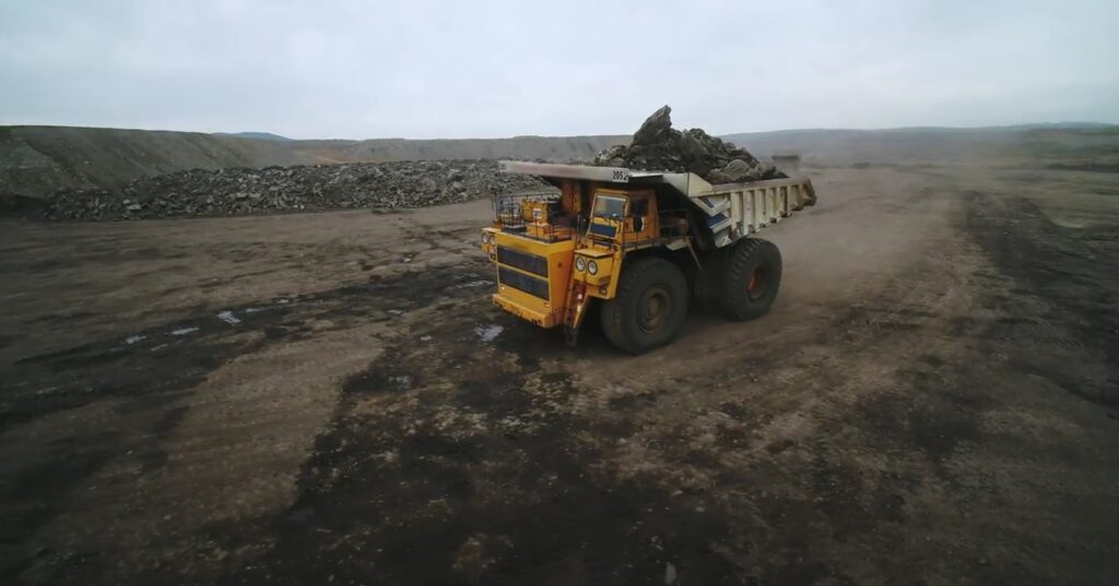
Explore how to establish a reliable radio network coverage in challenging mining environments. This webinar will delve into the best practices employed by global mining operators to design and manage their networks efficiently.
Date: 23 April 2024
Time: 1 pm Sydney, AUS // 11 am Perth // 10 am Jakarta
Reserve your spot now to acquire practical insights and strategies from industry experts. For the full agenda and registration, click here. Unable to attend? Register for the event and we’ll send you a link to the recording.


