We’re thrilled to see the relaxation of restrictions over the past month, indicating a return to normal life. This was reinforced by our attendance at the EU Spectrum Management conference and other leading events. We’ve also witnessed an upward trend in business opportunities coming through, indicating the onset of economic recovery and confidence across the industry.
This month we’re covering spectrum management updates from Europe, the latest map data available to support ground to air communications for airports, and our role in dimensioning the future of the telecommunications market at the ITU.
We’re taking a break for the summer, with our next publication due at the end of August. Our team is available throughout the summer for all sales and support queries.
To make life easier, we’ve captured a few of our new and updated features in bite-sized video clips. For the full updated list, download the document below. The latest version of HTZ is available for download in the CRM. If you have any questions, please get in touch.
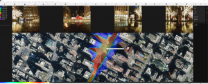
MW links v flight altitude
This feature checks if a MW link or a station link crosses a flight path described in the predefined IC2 raster file. The line of sight and the first Fresnel zone are checked for each activated MW link and station link on the map. The test is complete if both are below the altitude found in the raster file.
Interference calculation: Delta global interference map
This function allows the user to identify different interfered areas as a result of a new transmitter. This includes the given interference level or interfered areas in the existing network, and the location of new or additional interfered areas.
The “Delta global interference map” option has been added. This computes the interfered areas added by deactivated stations. The calculations are made in two passes:
Pass 1: Only activated stations (from the existing network) is considered and a “Global interference map” is built;
Pass 2: The deactivated stations (new stations) are added and a new “Global interference map” is created.
Result: The interfered areas are added to the existing network and as a result, the new stations are displayed with 255 code (pink colour by default). Interfered areas as a result of the existing network, only are displayed with code 1 (blue colour by default).
Network ID interference analysis
The “Delta Before/After” options have been added. By default, interference areas are checked in “Interference+Best server” mode: A point is interfering if there are no servers not interfered for a given Network ID. If the “Interference On best server” option is checked (available only for the first “Delta” feature) then interference levels are checked only on the Best server of each Network ID.
If the “Save as ITF_NETID_xxx.FLDs” option is checked, and an FLD file for each network ID will be generated showing:
– with 254 code interfered areas before;
– with 255 code, additional interfered areas after.
See attached information sheet for more information.
Propagation model: ITU-R 1546 sea
With the ITU-R P.1546 propagation model, the sea areas are now identified by areas where altitudes are lower than or equal to 0m and with a clutter code 6.
Use the Water polygons dataset (available from the Map download manager) to fill hydro clutter areas (oceans and seas) if no clutter is present or if clutter code 6 is missing in the current clutter layer.
Can Europe, where opinion is notoriously split, and cultural practices are even more diverse, ever agree to spectrum harmonisation? This question, along with many others, was raised at the recent EU Spectrum management conference (www.spectrummanagement.eu), where they debated whether an agreement could be reached between MNOs and industry to support vertical connectivity could be achieved.
Check out this months’ Blog which looks at the approaches taken to managing private 5G networks for verticals. It raises concerns in terms of harmonisation as well as how this might affect Europe’s ability to compete on a global scale and leverage their investments in 5G.
Read more here.
Air travel is forecast to grow over the coming decades, with more aircraft using our overly-congested airspace. For airport operators, aircraft safety is a top priority and this includes the ability to communicate with aircraft to ensure safety. Airports use three types of communication systems: ground communications for controlling operations, ground to air communications for managing airspace and radars for monitoring en route operations.

For engineering company Haysys, understanding whether an aircraft could be detected by ground control stations (direction finders) was a question they put to ATDI. To understand this, they requested coverage predictions for seven airports across Belgium, using 10W transmitters at different heights (1,000 ft, 1,500 ft and 4,500ft). These heights replicated the aircraft at the various stages of take-off and landing, as well as those en route.
At project kick-off, ATDI created high-resolution map data sets for the proposed airports, to model the coverage in HTZ Communications. The map data was imported into HTZ Communications, ATDI’s radio planning tool, and used to create coverage plots for each site at each given height. The outputs from the study were 21 coverage maps; three coverage plots for each airport at each height. These plots will enable airport operators to review their current network coverage and make improvements if they don’t meet regulations.
Similarly, a US airport operator needed high-resolution map data to model link budget analysis for their aircraft. ATDI was able to provide datasets for a handful of US airports. After the success of the testing phase of the project, the end user places an order for 90 airports across the country. This map data enabled the user to assess the connectivity of these vital communication links and propose mitigation solutions in HTZ.
Demand for low-cost high-resolution map data is on the up. Users need access to datasets to support existing networks and technologies and to support the exponential growth in markets such as 5G. These services require higher resolution datasets which can be expensive and sometimes difficult to source. ATDI offers high-resolution terrain elevation and clutter maps for most countries across the World. Their map data library features royalty-free map data and is available to users with a valid maintenance contract. Maps can be downloaded and imported directly into HTZ. The library is continuously updated and contains a growing number of datasets for airports around the globe.
ATDI has extensive experience working with airports, national civil aviation authorities and military air forces, supporting their work to maintain aircraft safety. For more information, visit our website.

A familiar face from ATDI is helping drive forward the work of the ITU through contributions to key ITU-R and ITU-D Study Groups (SGs).
Dr Haim Mazar is the company’s spectrum management expert whose role with the ITU dates back to 1991. Since joining the ATDI group in 2015, Haim has served as Vice-Chair of the ITU-R SG 5 on terrestrial services and ITU intersector coordinator on RF-EMF. His contributions subjects including RF spectrum management and monitoring, RF engineering (shared services, broadcasting, satellite communications, propagation and antenna patterns), Short Range devise (SRD) and RF Human hazards.
Since 2015, Haim has made nearly 80 contributions to the ITU-R on behalf of ATDI, authoring papers on regulations, spurious emissions, reviewing software, the economic aspects of radio spectrum and assistance for developing countries. In addition, Haim contributes to ITU-T SG 5: Environment, climate change and the circular economy.
Haim has previously organised regular football matches between ITU staff and World Radio Conference delegates at the WRC events.
On the ITU and his passion for football, Haim says, “Wireless communications has been a passion since completing engineering school in the 70s. It is both my pleasure and privilege to work with the administrations and the industry to make these contributions. Combining my love of RF engineering and football provides a great way to bring people together – something greatly missed over the past 18 months. I look forward to joining my colleagues face-to-face soon.”
Click here for a full list of Haim's contributions
Overview of the complete solution, with highlights of key products. Includes video links.
Adaptable monitoring solution to assess and control emissions
ICS RF Allocations – product demo
Web-based publisher for national FAT and RIR data editor
Spectrum-sharing strategy: Area-wide apparatus licences (AWLs)
A webinar featuring the approach used for ACMA, the Australian regulator to the management of AWLs.


