In this month’s Newsletter, we look at the evolution of satellite services. These changes bring new business models across many industries and affect how we manage access to spectrum, coexistence, and frameworks to support and encourage innovation. Many customers turn to HTZ to respond to their network issues. In this edition, we look at a case study looking at how to analyse the impact of a satellite antenna on HF systems in the spurious domain and the latest signal jamming between a satellite and a connected Earth station.
We also introduce our software developers kit for HTZ Warfare. This multifunctional feature allows users to create and manage automated workflows for planning automation using action codes. The HTZ API supports integration with third-party systems. Lastly, ATDI integrates the latest map datasets from the MaXar portfolio.
Our sales and support steam run throughout the summer. Please contact us for product information, support contract renewal and other services. Wishing you all the best over the summer break
From the ATDI team
The ability to jam an RF signal effectively is impacted by interference from the jamming signal strength or the distance from the signal transmitter.

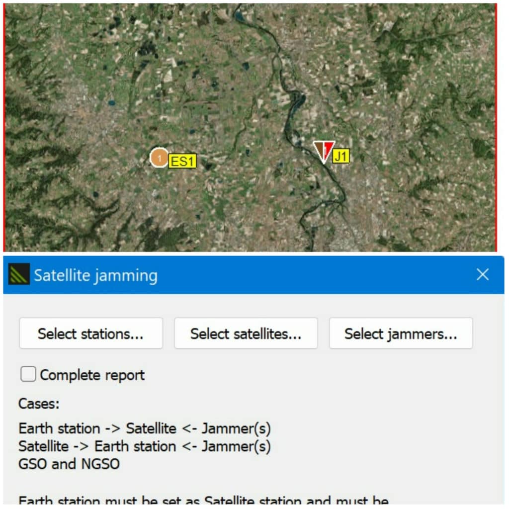
HTZ features the ability to check the efficiency of a jammer between an Earth station and a connected satellite (GSO or NGSO). This latest function checks the Earth station’s receiver and the satellite receiver, with each Earth station needing to be connected to a satellite, and the jammer intersecting with the satellite frequencies. HTZ provides the results of these calculations in terms of jamming signal received level and wanted signal received level (J/S) and the jamming signal received level and the thermal noise of the receiver (I/N). All the satellites in the same notice are tested.
For full details of this and other new and improved features in HTZ v.23.6.2, visit the CRM portal.
Users will benefit from additional map data sources from the MaXar portfolio. These raw satellite images are used to create high-resolution datasets, which are available on request. For an annual subscription, users can access the latest maps directly through HTZ. Users connect to the MaXar server using the SecureWatch API from directly within HTZ, to display the latest images available on their WMTS. Most MaXar maps are typically sourced within the past 48 hours.
To identify changes within the scanned environment, Maxar uses an image-based change detection layer to highlight areas where new construction or other activities are ongoing. As a result frequency of satellite scanning, these maps are well suited to tactical network planning and deployments, as they reflect recent changes in the environment.

To learn more about how your organisation can benefit from these datasets, contact your local office today for pricing. Click here for the product brochure.
ANALYSING THE IMPACT OF SATELLITE ANTENNAS (KA-BAND) ON HF SYSTEMS IN THE SPURIOUS DOMAIN

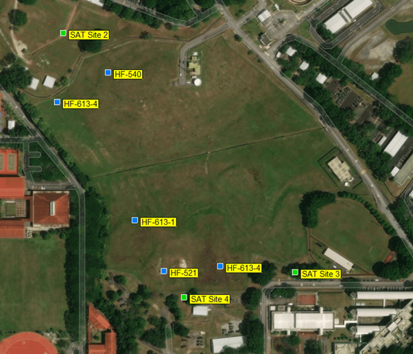
Consultancy projects come in all shapes and sizes. ATDI was asked to analyse the impact of the Thales Alenia Space Ka-band antenna on existing HF systems in the spurious domain. The Thales Alenia Space project team approached ATDI to compare calculations they had undertaken from their Ka-band antenna into an HF system in the Jurong Camp in Singapore. The aim of the study was to mitigate interference between the two systems and allow them to exist in harmony.
Thales Alenia claimed the antenna configuration caused changes in the radiation pattern shape and gain of the HF antenna. While crude estimates about the potential impact had been made, Thales wanted a comprehensive study to be completed, supported by high-resolution digital maps.
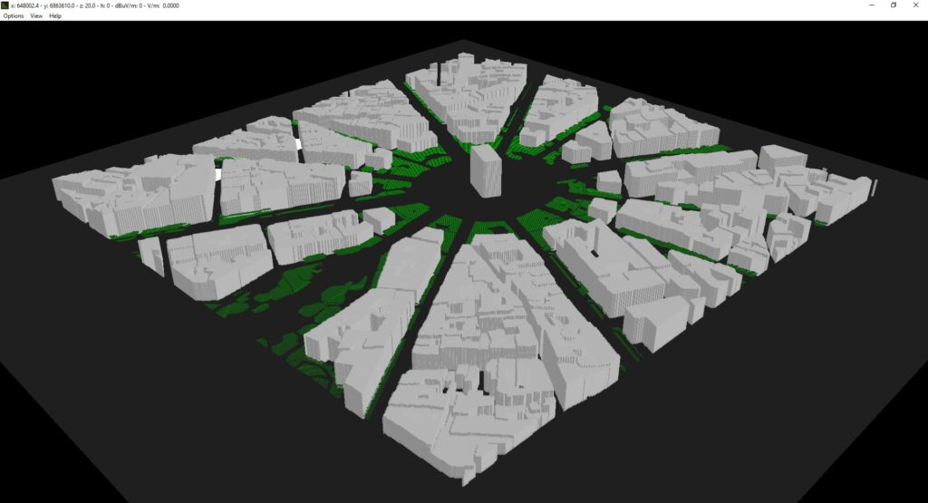
The spurious power radiated by the Ka antenna was defined according to Thales measurements, which looked at the separation distance between the Ka antenna and the HF 540 antennas at 85m. Using the results from these calculations, exclusion zones were set up for the HF antennas for up to 30MHz, identifying areas which could not be protected. The study also considered the construction of new buildings proposed near the Ka antenna. By adding the new building sites, ATDI were able to compute the interference from reflections.
The analysis was undertaken over three locations with the maximum signal reflected and the sum reflected signals generated. The outcomes of the analysis saw unwanted emissions in the spurious domain computed using less stringent spurious power in 10 kHz bandwidth and with an HF antenna gain at 0 dB was considered the worst case of interference. Based on ITU-SM 329-12 method (maximum permitted spurious domain emission power), it was determined that the Ka antenna could affect the system gain of the closest HF antenna by 0.5 dB. Compared to the Thales measurements (-150 dBW/4 kHz), the Ka antenna would not affect the system gain of the closest HF antenna. ATDI recommended an exclusion zone, even though the threshold degradation on the HF receiver was very low (<= 0. 03 dB).
Check out our case study, here.

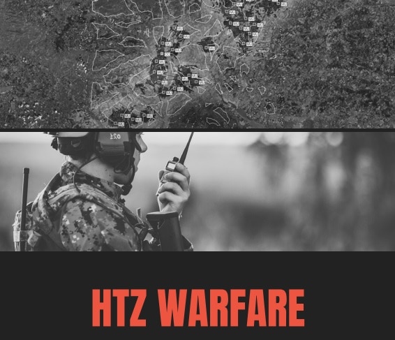
ATDI introduces an HTZ Warfare software development kit (SDK). The SDK is multifunctional allowing users to create and manage automated workflows for planning automation using action codes, and supporting integration with third-party applications via a Web API. The integrated API allows HTZ to seamlessly connect the HTZ spectrum engine to other systems or platforms, allowing integration into larger systems. The automated workflows provide a simplified end-user experience and enable organisations to make process efficiencies.
The Web API simplifies integration by using a request script to send messages to the HTZ spectrum engine. The calculations are undertaken in HTZ and the results are exchanged in XML or JSON format between the applications. The solution offers a high level of interoperability with plug-in functions to meet end-user requirements.
Using predefined action codes in HTZ, users can create workflows to perform automated calculations. Actions codes can be created for almost every function of the software and cover all types of study or analysis. The SDK provides self-management control of the integration and workflow automation and reduces the need to involve third-party suppliers. Over the project life cycle, this saves time, resources and reduces risks.
To learn more about how to access our software developers kit, contact your local office today.

Join the ATDI team at the leading public safety and transport expo, APCO 2022. This two-day event unites mission-critical and business-critical end-users to share inspiration, knowledge and connections.
ATDI will introduce HTZ for network planning, modelling and optimising secure, resilient mission-critical networks. ATDI plays an integral part in providing wireless connectivity for real-time situational awareness and intelligence-driven solutions. HTZ supports every radio technology including TETRA/DMR/PS-LTE/P25/MW, UHF/UHF, 5G and Wi-Fi and is used by military and civil markets across the globe.
Register today and pop by ATDI Stand #1460 to learn more about our solutions and discuss your network issues with our RF engineering team.


