This month’s Newsletter brings you the latest updates from HTZ with new features to support jammer search sites and FIPS encryption compatibility. We look at the latest functions to support FCC contours for broadcast in the USA, and a use case from the world of air traffic control.
Our September offers see HTZ Warfare users access a MaXar subscription free of charge till the end of the year. HTZ Warfare users will benefit from a free three-month trial of the service, accessing the latest high-resolution maps available. Contact your local office today. We're also growing our cartographic library, with regular updates and additions of cities and countries.
With lockdown but a fleeting memory, ATDI is now attending more face-to-face events. We look forward to meeting up with customers new and old soon. Check out our latest recruitment drive and understand how universities and research organisations benefit from our Academic licenses.
Best regards from
The ATDI team
Check out the latest new and updated features in HTZ in this month's video update, click here.
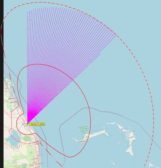
Jammer site searches
Improved - to check at a given point when the receiver is jammed. This checks the power received from the jammer and the wanted signal and compares it against the j/s signal using a polygon. The demo video shows the two available site searching options and analysis outputs. The new function also includes the coverage calculation percentage of receivers successfully jammed once a new jammer is added.
FIPS encryption
New – the license server file was updated to manage FIPS (USA) and encrypted license files.
Windfarms
Improved – to convert a wind farm object into an obstacle now considers the radius of the mast or diameter of the blade.
New – the ability to add the power sum from each reflected signal from the wind farm.
Satellite
P2P satellite connections allow users to check connections from a given point to a given satellite. P2P MW links – multibeam antennas – addition of Cambian antenna.
Rx level – now updated by subscribers, with the option to update from power received.
Propagation
Improved - Multipath 3D propagation model (specular / Lambertian) with improved calculation engine to request updated default reflection factors. It applies specific values for different clutter codes to improve the accuracy and speed of calculations.
Mobile
RSRP thresholds are now available for 4G and 5G. These thresholds are defined separately (previously combined) for each technology. If the station is a 5G station, then the threshold will be used for displaying area coverage, etc.
P2P/PMP/MW links
The interconnection map allows the user to check the point at which two stations can be interconnected using the invisibility mode function or in the field strength aggregation.
Interface & Reports
Tx/Rx equipment lists – ability to delete a selection of records from a database.
Import generic ASCII file – the previous function only imported stations and subscribers but can now import text vectors containing coordinates and command information.
Import ASCII Rx dBm level when using generate report function. Populates the information to support the jamming subscriber function.
We’ve simplified our product version numbers for HTZ and ICS Manager: version xxxx.yy.z with xxxx = year and y or yy = month. z denotes when more than one release is in the same month. For example, 2022.7 was released this month and 2022.7.1 = the second release in the same month.
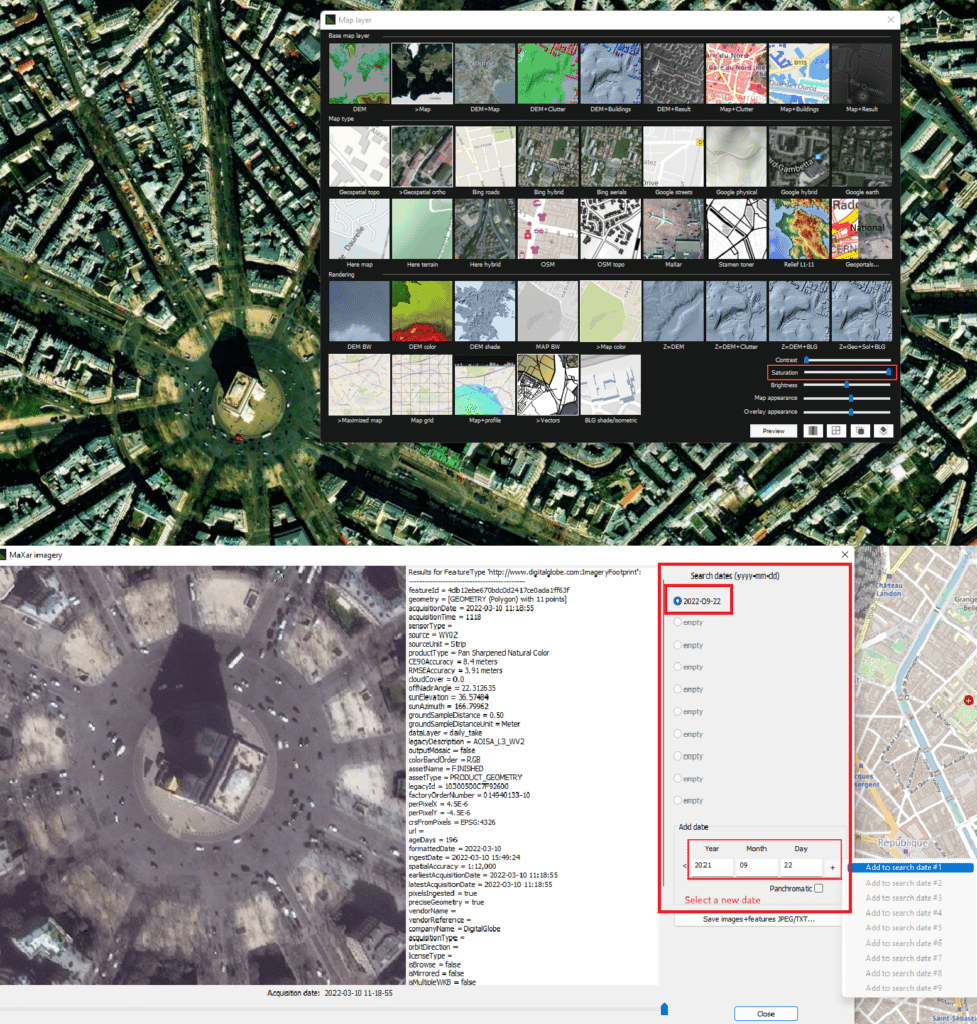
ATDI offers HTZ Warfare users free access to MaXar maps till the end of the year. This subscription-based service is compatible with HTZ and allows users to access the latest vintage high-resolution cartographic datasets via their WMTS portal.
Users connect to the MaXar server using the Secure Watch API directly from HTZ, to display the latest images available on their WMTS. These enhanced maps provide the most up-to-date datum for mission-critical planning (up to 48 hours, where available).
The frequency of satellite scanning makes these maps well suited to tactical network planning and deployments. The MaXar API service in HTZ is available as an annual subscription.
To learn more about how your organisation can benefit from these datasets, sign up today for our free three-month trial.
HTZ generates contours according to FCC rules. These are applied for coverage of services for FM broadcast, TV and land mobile radio. This methodology gives an approximate coverage and interference and the contours use different reliability values in the curves. Each contour is represented as a contiguous polygon with areas with no coverage shown.
However, FCC contours do not apply for AM broadcast. HTZ encapsulates the groundwave model with a conductivity map loaded for a given area. The coverage contours can then be extracted for the values 0.5mV/m (54dBµV/m) and 2mV/m (66dBµV/m).
Alternatively, HTZ features a Threshold limited polygon function, which replicates contours identified by FCC, with a difference of around +/1dB. To support this function, ATDI has produced a dataset (DTM and conductivity) with a 90m resolution. This dataset is created from a 30m dataset of the USA, available via the Map Download Manager for the DTM and the FCC conductivity map (AM_m3), which is also available for download.
For the full white paper, click here.

ATDI adds another aviation authority to its list of customers in the aviation industry.
The Irish Aviation Authority (IAA) purchased HTZ Communications earlier this year and undertook a custom training course. The IAA provides air traffic management services for Irish-controlled airspace, as well as safety regulation and civil aviation security. The training course familiarised users with the main features and functions of HTZ Communications, with a focus on modelling VOR and ILS.
Users learned how to model VHF stations to support ILS using SM.1009. The course also featured a session on modelling primary and secondary radars and how to model the impact of 5G antennas on ATC radars.
To learn more about the vital work we undertake in this sector, click here.
Getting hands-on experience with a leading RF planning tool adds value to a graduate's CV and can improve their career prospects.
At ATDI, we’ve been supplying academic licenses to students for the past three decades. Universities can purchase licenses in packs of 10 or 20 at a discounted rate to support their curriculum and allow students to incorporate real-life experience planning and modelling networks.
The offer extends to both civil and military institutions. These licenses are proving increasingly popular with ATDI supporting a host of universities including Glasgow Caledonian University (Scotland), Kärnten Carinthia University of Applied Sciences / Faculty of Network & Communication Engineering (Austria) and Gdynia Maritime University (Poland).
In Malaysia, students use the software both in a classroom environment and to support their joint 5G initiative run in conjunction with Ericsson. This program provides training and consultancy services to the industry to support the development of Malaysia’s 5G networks.
For more information about our academic licenses, contact us today.
Attendance at leading industry events enables us to meet and connect with customers. Our experienced team members will demonstrate the solutions and offer you a trial license. Please schedule your visit to our team at one of the shows and discuss your network design and deployment requirements.
EuMW & EURAD 2022 (Booth #A43) – Milan, Italy – 27-29 September – presenting our RF solution for MW, Radar, 5G and multi-technologies coexistence analysis and coordination.
RegFest – Montenegro – 26-28 September - ATDI will present this Eastern European regulatory event focussing on the principles of DAB Planning.
ISNR (Booth #09-C37) – Abu Dhabi – 10-12 October – presenting our RF planning and spectrum management solution for critical comms, defence and security agencies.
Americas Spectrum Management Conference – Washington DC, USA – 11-12 October – During this two-day event, ATDI focus on solutions for multi-technologies coexistence analysis and coordination between technologies including 5G, Wind Farms, Radars and more.
CommsConnect 2022 (Booth #74) – Melbourne, Australia – 18-20 October – This event unites the public safety industry for three days of conference and expo. ATDI will share their experience in planning and optimisation of VHF/UHF, MW, Drones/Anti-Drones, PS-LTE, 5G and planning automation.
AOC International (Booth #153) – Washington DC, USA – 25-27 October – presenting our electronic warfare and military tactical plan solutions to military, government and security agencies.
PMR Expo (Booth #A3) – Cologne, Germany – 22-24 November – We will present our most advanced network design and management solutions for PMR/TETRA/DMR network operators. In addition to HTZ Communications, the team will demo their network operating web platform, ICS Portal.
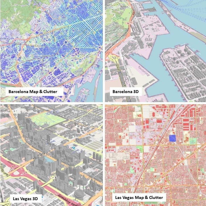
ATDI continues to develop and grow its cartographic library, providing HTZ users with royalty-free maps from across the globe.HTZ users benefit from improved map data quality as new vintage and high-resolution maps are added weekly. The latest datasets consist of:
New features have been added to the MaXar subscription including the ability to request acquisition data for a given area on the active view by clicking on a given pixel. This feature retrieves imagery and the metadata and allows the user to save the image as a JPEG and the metadata into the text file. Users can export active views as a GeoTIFF for import into QGIS or any other GIS software that can ingest geocoded data.
Access to the Map Download Manager is available to users with a valid maintenance contract. To renew your maintenance contract and access the latest version of HTZ, contact us today.

ATDI thrives on people. Its finest tool is its engineering expertise.
We’re committed to recruiting and retaining the best industry people. If you’re interested in joining a dedicated and competent team of professionals who understand what it takes to get a job done and have the experience and determination to succeed, then contact us today.
We are currently recruiting for the following positions:
RF Engineer – Paris, France
Junior RF Engineer – Washington DC, USA
Software Development Engineer – Paris, France
For more information and to check out the job specifications, visit our careers page.


